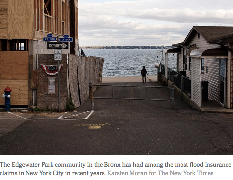
With its 520 miles of coastline and thousands of acres of waterfront development, New York has more residents living in high-risk flood zones than any other city in the country. Hurricane Sandy, the devastating October 2012 storm, did $19 billion in damage to the city, and the pace of development along the water has only increased.
Now, after a year in which hurricanes ravaged Houston and the Caribbean, the Federal Emergency Management Agency is substantially redrawing New York’s flood maps for the first time in three decades. It is a painstaking process that will affect tens, if not hundreds, of thousands of people, determining how and where buildings can be constructed and the cost of flood insurance on everything from modest bungalows to luxury skyscrapers.
New York will be the first major metropolis to be remapped taking into account the realities of climate change, like rising sea levels and increasingly powerful storms.
The new models, for coastal areas stretching from Cape May to the Hudson Valley, will be used to shape the city’s future zoning, development and building standards to help it become more sustainable. As a result, FEMA and city officials say, New York could be an example for other places around the country.
But the maps will also be shaped by the history of New York, where 80 percent of properties were built before the current flood maps and requirements were in place, as opposed to 20 percent nationally, noted J. Andrew Martin, acting chief of FEMA’s risk analysis branch in New York. If those older buildings end up in high-risk zones, their owners could be required to buy flood insurance or make expensive modifications, adding costs that are beyond the reach of many working-class homeowners.


